How to find the elevation of any point on Earth using Google Maps
The short answer to this question is: by using Google's Elevation Service. Additionally, you can find the elevation of a point on Earth's surface using the same data from Google Maps, via third party websites.
In this tutorial we'll go through some of these online services you can use, but first, let's clarify what elevation and altitude is all about.
Elevation and altitude are considered synonyms by most people, but some distinctions can be made.
In layman's terms, Elevation means the vertical distance from the surface of the sea to the location of an object. It can also have a negative value for underwater locations.
Altitude also means the vertical distance from the sea's surface to a location, but it is used for locations above the Earth's surface, such as flying airplanes.
Like I said, Google does have an Elevation Service, accessible via API as well, so we'll start with it.
1. Find elevation in Google Maps with Google's Elevation Service
Strangely enough, Google Maps does not display this information on the regular Maps accessible at https://www.google.com/maps.
They do however display the elevation of any point on this page.
On that page you can simply click on the map and it will show you the elevation of the location you clicked on.
You can't search for locations, but you can zoom in and out and switch between satellite map and street map.
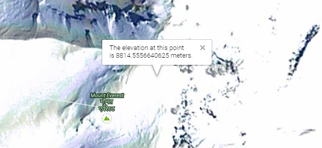
Above: Example of elevation for mount Everest
2. Elevation from Geoplaner
Accessible at: www.geoplaner.com.
The Geoplaner website uses the same elevation data from Google Maps, but also features a search option. In addition to that, you can enter locations using coordinates, in several formats.
It shows elevation in meters or feet, default in meters. Besides Google's street and satellite (with or without labels) maps, you can also switch to OSM (Open Street Map).
Geoplaner does much more than just show elevation. You can also:
- Create routes and waypoints, which you can drag around
- Export/Import these routes and waypoints
- Create a link to the map you are looking at, containing all the waypoints and routes you created; this option is below the map.
Here's an example of a saved link to a map showing the elevation of Mount Everest http://www.geoplaner.com/?z=10;p=27.98803,86.92523;.
3. Elevation from Altitude.nu
Accessible at: www.altitude.nu.
To use this Google Maps powered service, simply click on the map and it will display elevation for the clicked point, plus coordinates to the top left of the map. You can drag the waypoint around with your mouse.
You can click on "Known places" to see some famous locations on Earth and get an idea of how the service works.
Altitude.nu does not have a search option.
The top right toolbar on the map has the following options:
- Map/Satellite - switches between the two types of maps
- Meter/Feet - toggles between the two
- Show/Hide position - once you have a waypoint created on the map, you can click "Show position" to display its coordinates alongside the altitude(elevation) value
- Clear - clears all waypoints on the map
- Save - once you created one or more waypoints, you can click "Save". This will create a custom URL for the map in view, containing the waypoints currently displayed.
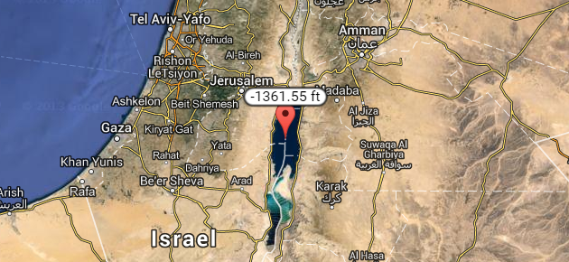
Here's an example of a saved link showing the negative elevation (in feet) of the Dead Sea, the lowest land point on Earth: http://www.altitude.nu/index.jsp?id=6022.
Above: Example of negative elevation for the Dead Sea
More online services
If the options above does not suit your needs, you can also try:
- http://www.mapcoordinates.net/en
- http://www.daftlogic.com/sandbox-google-maps-find-altitude.htm
- http://www.gpsvisualizer.com/elevation
- Google Earth - downloadable for PC, Mac, Linux
Final words
That's it for now. Until Google decides to add the elevation information directly into Google Maps, the options above will have to do.
Leave a comment if you have anything to add.


